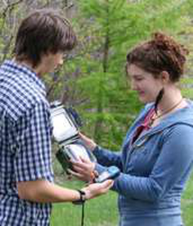
Geocaching is an easy and fun activity. All you need is a few hours to spare, a hand-held GPS device, and a sense of adventure!
2023 – Local History Geocache Sites – Southwest Manitoba – TMSPHA
Surrounding Melita – RM of Two Borders
Brockington Bison Pound Lat: N 49°12.067’ Long: W 101°02.011’
Alfred Gould’s House – Sourisford Lat: N 49°08.024 Long: W 101°00.480’
The Empress of Ireland Lat: N 49°05.322’ Long: W 100°59.039’
Boundary Commission Trail Lat: N 49°08.917’ Long: W 101°00.222’
NEW – Gone to the Dogs Lat: N 49°23.677’ Long: W 101°05.282’
Surrounding Hartney – RM of Grassland
St. Jean Parish – Grande Clairière Lat: N 49°30.285′ Long: W 100°42.155′
Lauder Sandhills Lat: N 49°27.426’ Long: W 100° 41.310’
The Fur Trade in the Souris Basin Lat: N 49°25.745′ Long: W 100°42.150′
Chain Lakes: Bison Hunt Camp Lat: N 49°21.891’ Long: W 100° 29.500’
NEW – Riverside Bridge Lat: N 49°30.093’ Long: W 99°59.398’
NEW – Fairfax Church and School Lat: N 49° 26.141’ Long: W 100°07.621’
Surrounding Waskada – RM of Brenda-Waskada
Railroads Reach the West Lat: N 49°05.731′ Long: W 100°46.810′
Turtle Mountain Coal Mining Lat: N 49°03.520’ Long: W 100°33.401’
Bison: King of the Plains Lat: N 49°05.306′ Long: W 100°32.456′
NEW – Lowe Family Natural Area Lat: N 49°01.733’ Long: W 100°45.350’
NEW – Napinka School Lat: N 49°19.483’ Long: W 100°50.667’
Surrounding Deloraine – RM of Deloraine-Winchester
Prairie Skills Centre Lat: N 49°11.528′ Long: W 100°29.785′
Old Deloraine Cemetery Lat: N 49°07.887’ Long: W 100°24.324’
Marsden School No. 2 Lat: N 49°00.603′ Long: W 100°22.084′
Surrounding Boissevain – RM of Boissevain-Morton
Buck’s Hill Skirmish Lat: N 49°12.376’ Long: W 100°04.910’
Dunseith Trail Lat: N 49°05.194’ Long: W 100°05.580’
Mandan Trail Lat: N 49°12.502′ Long: W 100°08.978’
NEW – Whitewater Lake Lat: N 49°13.363’ Long: W 100°15.766’
Surrounding Pierson – RM of Two Borders
James Dandy – Village of Pierson! Lat: N 49°10.846’ Long: W 101°15.415’
Bison Rubbing Stone Lat: N 49°07.240’ Long: W 101°17.692’
Oil in SW Manitoba Lat: N 49°06.647’ Long: W 101°20.327’
Copley Anglican Church Lat: N 49°01.805’ Long: W 101°15.114’
NEW – Diana Icelandic Cemetery Lat: N 49°29.298’ Long: W 101°21.280’